 |
| From mountain to sea - or fjord |
This morning we left Gjogv on Eysteroy Island bound for the northern islands. But first we had to again negotiate that precipitous switch-back road straight down the massive Slaettaratindur Mountain. I think we’re becoming the teensiest bit desensitised to the roads here, but maybe the fact that I keep mentioning them suggests not! We still come 'home' drained. Today we had to pass a tourist bus on one of those shocking hairpins - of course it was us that had to hang our wheels over the edge! Not a happy prospect!
 |
| No way from point A to point B but through a mountain |
Lindsay is doing an awesome job as our designated driver. We have passed through so many tunnels that I have lost count. A few are two lanes but most are single lane which is a bit scary - you have to pull into a wee off-road spot if you see traffic coming the other way. Then there are other one-lane tunnels which are controlled by traffic lights – they seem to be the older ones built back in the 1960s, old and small – 2.8m wide. We popped out the end of one 3km tunnel only to disappear in a dog leg into another. Nerves of steel, did you say?! Hah. Someone asked "why so many tunnels?". The central image probably explains it - towering mountains/hills many of which drop precipitously straight into the sea. This is a land of deep fjords!
Tunnels aside, the day was absolutely wonderful. We drove to Vidareidi, the northernmost village on Vidoy Island - and the Faroes. To the north is the 750m high Cape Enniberg, the northernmost point on the Faroe Islands and one of the tallest sea cliffs in the world. They say it drops vertically down into the ocean – some adventurous souls climb this high promontory. Sheer madness but …. we instead had a wee picnic above the village looking out over a cluster of islands. Glorious.
 |
| We snacked overlooking the sea and islands. The picnic table was held down by large boulders - it's very windy here on the edge of the North Atlantic Ocean |
 |
| Kunoy island viewed from Vidoy Island |
 |
| From Vidareidi looking towards Cape Enniberg |
 |
| There were WCs in most villages - thank you!! |
 |
| We visited many churches and graveyards. This is a modern church but many have traditional tuft roofs |
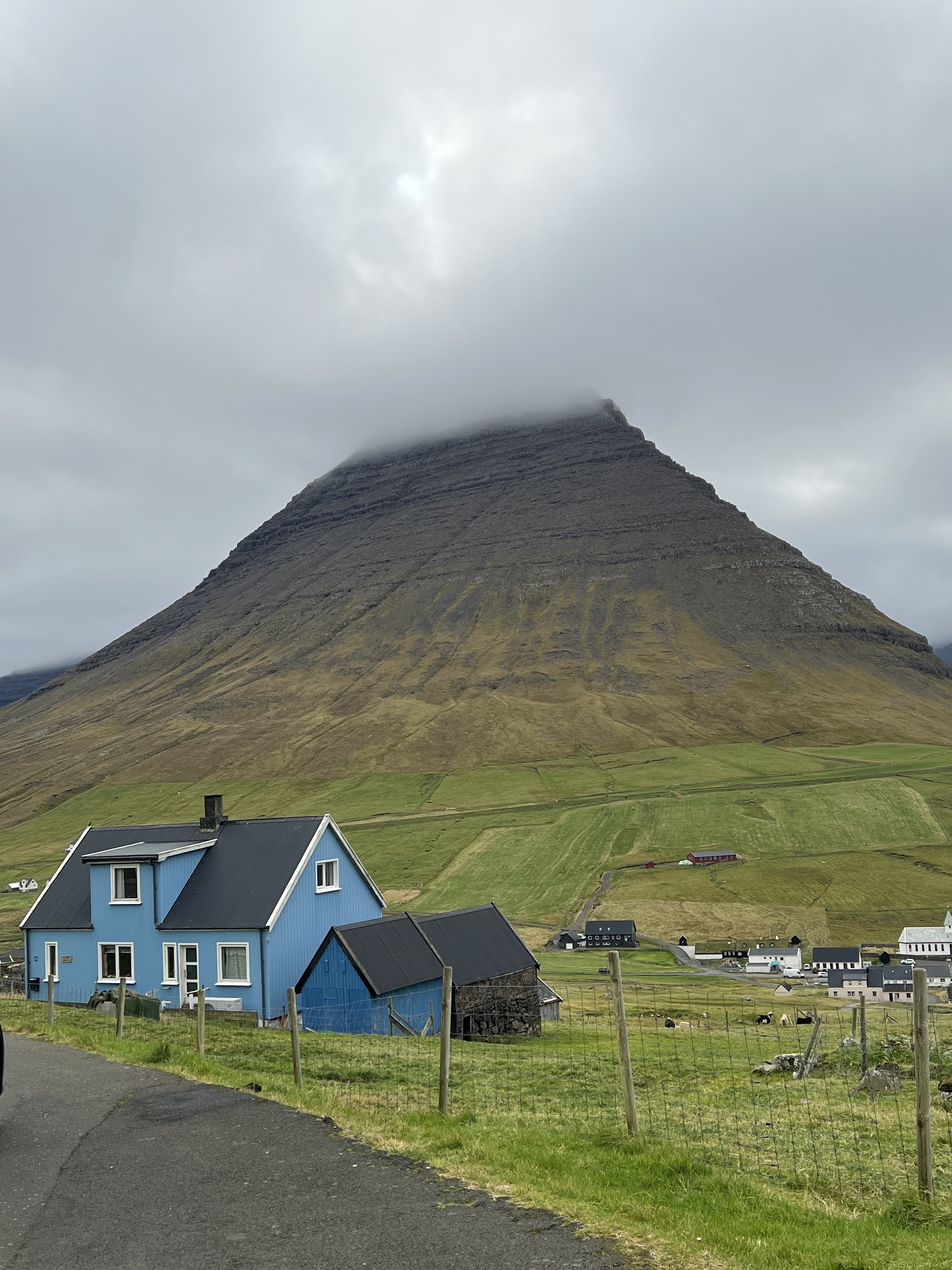
Post picnic, we headed over to the island of Kunoy which is accessed via a curvy causeway. Kunoy is the highest island in the Faroes and is dominated by a magnificent pyramid mountain. To get to the other side of the island and the village of Kunoy? You guessed it – a tunnel. Of course, we drove through the tunnel to explore and what a quaint quiet wee hamlet we discovered. I’m not sure how many people visit the west side of the island, but the sheep were certainly curious to inspect us.
 |
| Approaching the wee hamlet of Kunoy |
 |
| Beyond the bitumen, tranquility plus! |
 |
| Clouds hug the towering crags |
 |
| The hamlet of Kunoy - looks idyllic |
 |
| The ladder used to haul the boats to safety |
 |
| Hedges of dainty fuchsia waved us along |
All too soon it is was time to make tracks back to Klaksvik where we were staying a couple of nights. Klaksvik is the second largest city in the Faroes and is an important fishing harbour but it is still a quiet place. (The Faroes are wonderfully quiet but then we hadn’t reached the capital city at this stage – that was still to come!) In Klaksvik, we were staying in a delightful hotel which harked back to more elegant days, a little art deco and almost a suite to ourselves with views over the mountains and the harbour.
 |
| The bed was rather gorgeous with its built in clock and radio |
 |
| A room with a view! |


No comments:
Post a Comment